 Lake Como Guidebook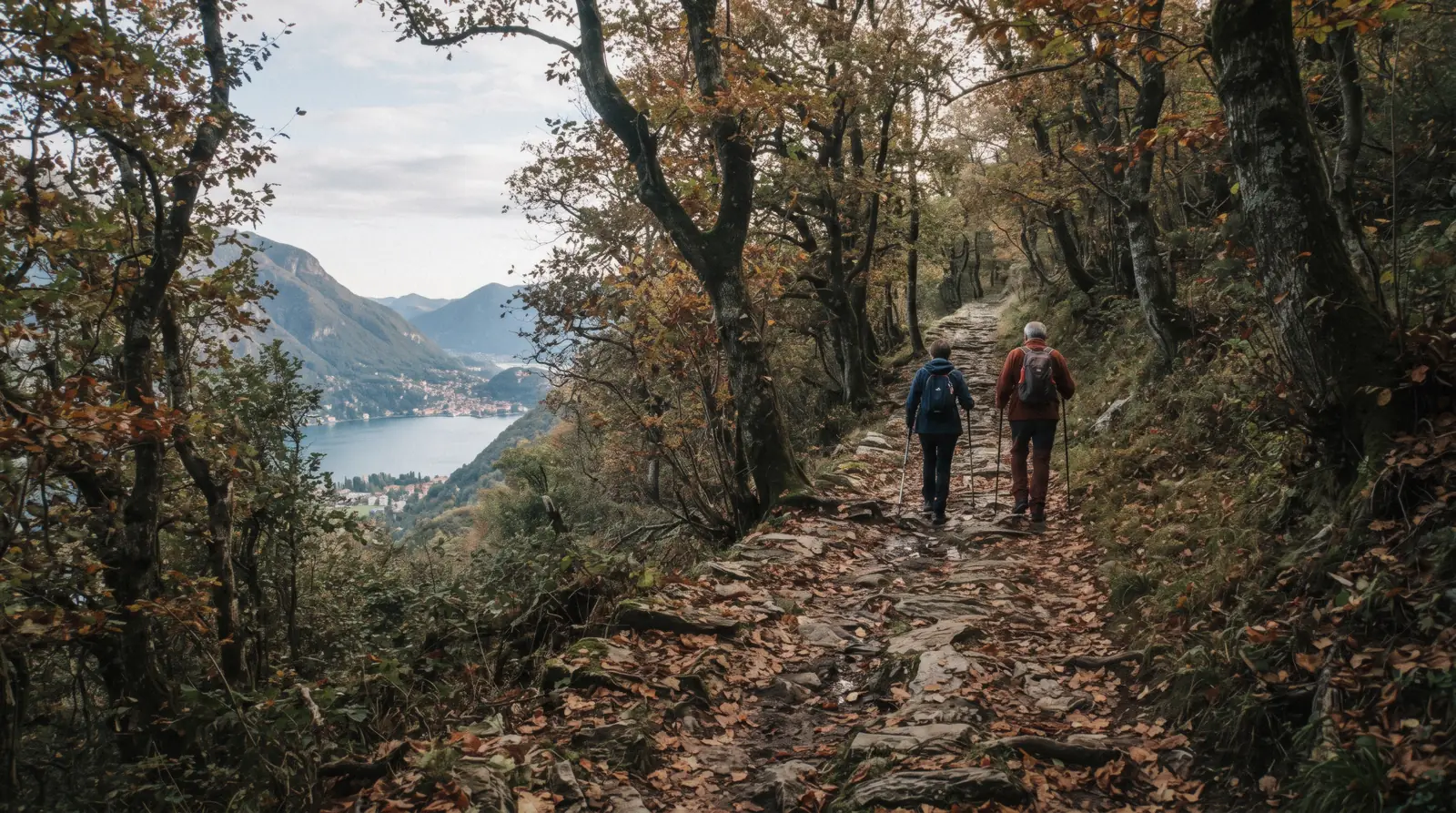
Lake Como Hiking
Exactly one Lake Como hiking route publishes a full technical description, and it is 11.2 kilometres long; everything else above this lake is better than its reputation and worse documented than almost anywhere comparable in the Alps. The mountains rise straight out of the water, so a walk here is nearly always a climb; the comune of Tremezzina runs from 198 to 1,689 metres inside its own boundary, and Lecco's territory tops out at 1,849. What is missing is data. Outside one route, no authority on this lake publishes a distance, an ascent or a walking time for its own trails. This page prints what is published, names who fails to publish the rest, and spends most of its length on the thing that actually ruins walks here: the boat that gets you to the trailhead runs to a timetable that changes four times a year. Everything was read in Q3 2026. For the route that does publish its numbers, see the Greenway; for the rest of the trip, the whole lake guide.
Quick answer Which walks publish real numbers, and which do not
Exactly one walk on Lake Como publishes a full technical description: the lakeside route through the seven villages between Colonno and Griante, at 11.2 kilometres, 221 metres of climbing and 257 of descent, quoted at three and a half hours by its own official site. For everything else, from the Sentiero del Viandante along the eastern shore to the ridge walks above Brunate and the paths in the Grigna regional park, no comune, park authority or tourist board publishes a distance, an ascent or a time. The one exception is the short loop from Varenna up to the castle at Vezio, which Varenna's own tourism portal puts at about 30 minutes and about 160 metres of climbing.
Key takeaways
- The walks table lists every named route with what its own source actually publishes, and the blanks are the finding rather than an omission.
- The 11.2-kilometre lakeside route is the one with real numbers, and its trailhead at Colonno sits inside a road works zone running to 2028; check the official works page before you go.
- Most trailheads are boat-reached and the boat decides the day: an ordinary ticket is valid on the day of issue only, and the timetable windows show how few calls some landing stages get.
- For a walk with a guide and no route-finding, a Como and Brunate walking tour starts from the city rather than from a pier.
The Named Walks, and What Their Own Sources Publish
Eight routes people ask about, checked against the official body responsible for each: the route's own site, the comune, the tourism portal the comune endorses, or the regional park. Where a cell reads not stated, that authority publishes no figure.
| Walk | Where it starts | Distance | Ascent | Time |
|---|---|---|---|---|
| The lakeside route, Colonno to Griante | South end of Colonno, at the bus stop and car park | 11.2 km in the technical box, 10 km on the trail page | 221 m up, 257 m down; high point 276 m, low point 191 m | 3:30 |
| Anello del Castello di Vezio | Varenna, up to Vezio di Perledo | Not stated | About 160 m | About 30 minutes |
| Sentiero del Viandante | The eastern shore, above Varenna and Bellano | Not stated by any official source we reached | Not stated | Not stated |
| Greenway dei Patriarchi | Varenna | Not stated | Not stated | Not stated |
| Sorgente di Fiumelatte | Fiumelatte, south of Varenna | Not stated | Not stated | Not stated |
| Sacro Monte di Ossuccio | Ossuccio, at the chapel car parks | Not stated; 14 chapels along the way | Not stated | Not stated |
| Parco Val Sanagra, above Menaggio | Menaggio, inland | Not stated by the comune | Not stated | Not stated |
| Moncodeno, Grigna Settentrionale park | Inside the regional park | Not stated | Not stated | Not stated |
That column of blanks is the honest state of Lake Como hiking information. The Parco Regionale della Grigna Settentrionale publishes a route section that turns out to be five interpretive panels for one Moncodeno itinerary, as PDFs, with no distance, ascent, time or difficulty grade anywhere on it. The Comune di Menaggio lists Parco Val Sanagra among its places of interest and publishes nothing about walking in it. Varenna's official tourism portal names four routes and prints figures for one of them. The domain that looks like the Sentiero del Viandante's own site fails its certificate check outright. Every confident kilometre figure you will read for these routes elsewhere came from a walker's tracker, not from an authority, and this page does not launder those into facts.
Why Every Walk Here Is a Climb
The lake sits at about 198 metres and the ridges behind it are between five and nine times that. The official altimetry makes the point better than any adjective.
These are ISTAT figures at 31 December 2021: the altitude of each town's built-up centre, and the full range of its comune territory. They explain why a walk that starts at a pier is never flat for long, and why the lakeside route through the seven villages, which stays between 191 and 276 metres, is the outlier rather than the norm.
| Comune | Centre | Territory range | Area | What that means on foot |
|---|---|---|---|---|
| Tremezzina | 209 m | 198 to 1,689 m | 29.4 km2 | Mean territory altitude 690.8 m: the shore is a thin strip below a mountain |
| Bellagio | 230 m | 196 to 1,666 m | 29.1 km2 | The promontory itself climbs hard from the first street behind the water |
| Lecco | 216 m | 195 to 1,849 m | 45.3 km2 | The highest ground on the lake, and the gateway to the Grigne |
| Nesso | 315 m | 191 to 1,397 m | 15.0 km2 | The village is already 120 m above the lake before you start |
| Menaggio | 210 m | 197 to 1,344 m | 11.8 km2 | Val Sanagra runs inland behind it, away from the water |
| Varenna | 228 m | 199 to 1,084 m | 12.6 km2 | The gentlest of the six, which is why its walks are the short ones |
What that does to a plan
Three consequences, all of them practical. A walk of two hours here is not a walk of two hours on flat ground; the Vezio loop covers about 160 metres of climbing in about 30 minutes, which is a steady staircase pace rather than a stroll. Shade is unreliable, because the terraced olive and chestnut slopes open out on the south-facing sections. And the climate is not a Mediterranean one: the lake averages 1,718 mm of rain a year over about 145 rainy days, and the wettest months are the summer ones, with August at 198.7 mm.
The wind is a real factor above the water rather than a picturesque detail. The Enciclopedia Italiana entry on the lake, from 1931, names the daytime valley breeze the breva, the night breeze blowing the other way the tivano, and the variable winds that produce the lake's abrupt changes the montivi. No agency quantifies any of them; ARPA Lombardia runs anemometers in the region and publishes no Lake Como wind study. What that means on a ridge is that the squall arrives before the forecast does.
The Eastern Shore: the Viandante and the Vezio Loop
The route everyone asks about, and what it does not publish
The eastern shore, from Lecco north through Mandello, Lierna, Varenna, Bellano and up towards Colico, carries the walk everyone asks about. The Sentiero del Viandante is described by Varenna's own tourism portal, published by the comune's tourism department and part of the Regione Lombardia Infopoint network, as an itinerary dating back to the Roman period that skirts the eastern branch of the lake. That is the whole of what an official source says about it. No stage list, no kilometre figure, no ascent, no walking time, no difficulty grade. The site that looks like the route's own presents a certificate that does not match its host, so it cannot even be read.
There is one piece of hard evidence that the route is an organised product rather than a line on a map, and it is a discount. Villa Monastero in Varenna gives 50 per cent off its regular entry to anyone showing a Viandante via Lago ticket at the door. That is a rail-and-trail combination, and it tells you the practical shape of a Viandante day: take the train up the eastern shore, walk one section back down, and use the villa as the reward at the end. The train is the right tool here, because Trenord carries bicycles free within Lombardy and Milano Centrale to Varenna-Esino-Perledo is 72 kilometres at $8.97 (€7.70) in about 64 minutes.
The short walk that does have numbers
The short walk on this shore is the one with numbers. The Anello del Castello di Vezio climbs from Varenna to Vezio di Perledo on an ancient connecting route, about 30 minutes and about 160 metres of ascent by Varenna Turismo's own reckoning. At the top, Castello di Vezio charges $8.16 (€7.00) adult and $4.66 (€4.00) reduced, opens daily from 1 March to 1 December, and stays open and lit until 22:30 on fair-weather Friday and Saturday evenings in June, July and August. From December to February it opens only on fair-weather weekends and holidays, and in November it closes if it rains. One correction worth making: the falconry display that still headlines most write-ups of this castle was permanently discontinued after the vandalism of October 2022, and the castle says so on its own page.
The other two Varenna routes, the Greenway dei Patriarchi and the walk to the source of the Fiumelatte, are named by the portal and described by category and by nothing else. Fiumelatte is a seasonal spring; the portal does not publish its season either.
The Western Shore: the Old Roman Road and the Ossuccio Climb
The Roman road and the one documented route
The western shore's walking is organised around the Antica Strada Regina, the Roman road that ran along this side of the lake, which the 11.2-kilometre lakeside route uses in stretches. That route is the one properly documented thing in Lake Como hiking: 11.2 kilometres in the official technical box and 10 kilometres on the same site's trail page, 221 metres of climbing against 257 of descent, a high point of 276 metres and a low of 191, no technical difficulty, and three and a half hours quoted on its own useful information page. It links Colonno, Sala Comacina, Ossuccio, Lenno, Mezzegra, Tremezzo and Griante, and it passes the San Rocco chapel above Sala Comacina, the tenth-to-twelfth-century church at Spurano and the Santa Maria Maddalena bell tower.
Villa Carlotta's own page puts Villa del Balbianello at half an hour's walk along it. Because that route has its own page here, this one does not repeat it.
Two current warnings on that trailhead
Two warnings attach to that trailhead and both are current. The route's official site maintains a live page reporting works in progress and active detours; check it rather than assuming a stage is walkable. And the road the trailhead sits on is a construction zone: the Variante alla Tremezzina is being built between Colonno and Griante, with the works handover signed on 22 March 2023 and an official end of works date of 10 April 2028.
A standing ANAS ordinance regulates traffic from 15 March to 15 November every year, a mixed traffic-light management trial has been running between Colonno and Griante since 16 March 2026, and the precedent for what can happen is Colonno being shut from 29 November 2021 to 29 March 2022.
The climb through fourteen chapels at Ossuccio
The climb on this shore is the Sacro Monte di Ossuccio, a UNESCO World Heritage site since 2003, with fourteen chapels and around 230 statues along the path up to the sanctuary. Cars are not allowed up to the sanctuary itself and there are two chapel car parks instead, which makes this a walk by design rather than by choice. The sanctuary is explicit about the surface: the route between the chapels has steps, cobbles, paving and unsurfaced sections, slopes and architectural barriers, and it describes disabled access as difficult.
Visitors who cannot walk it may drive up with a disabled badge by prior arrangement with the rector on +39 0344 55211.
Above Menaggio, the record goes blank
Above Menaggio the picture goes blank again. The comune's own list of places of interest names Parco Val Sanagra, a protected local park established by provincial deliberation number 183/27914 of 30 June 2005, the Linea Cadorna fortifications of 1916 and 1917 at the Crocetta hamlet with the little church of San Maurizio, and the Antica Strada Regina. These are genuinely walkable and genuinely worth the morning.
The comune publishes no route, no distance, no ascent and no time for any of them, and neither does the association that runs the town's tourist office. Ask at the Infopoint at Piazza Garibaldi 3, which is open daily 09:00 to 13:00 and 14:00 to 18:00.
The Brunate Ridge, and the Lift That Does the Climbing
Why Brunate is not a boat stop
The southern end of the lake has the most accessible high walking, because a funicular does the climbing. Brunate sits 689 metres above sea level, some 475 above Como, and has no pier at all, which is the first thing to understand: you do not arrive there by boat under any circumstances. You arrive by the Funicolare Como to Brunate, which opened in 1894, was electrified in 1911 and rebuilt in 1934 and 1935, and has been run since July 2005 by the Consorzio Mobilità Funicolare & Bus with the operating role assigned to ATM, not to the bus company ASF.
The fares and the frequency
The practical numbers are good. The journey takes seven minutes. It runs every day from 06:00 to midnight, every 15 minutes from 06:00 to 07:00, every 12 minutes from 07:00 to 09:00 and every 15 minutes from 09:00 to midnight, with the last departure at midnight. Tickets are not timed. The lower station is at Piazza Alcide De Gasperi 4, and there are request stops at Como Alta and Carescione. A single is $4.31 (€3.70) and a return $8.62 (€7.40) on the operator's sheet in force since 1 September 2026; two older sheets are still online at 3.60 and 3.30 euro, and the funicular page sets out which is which. A bicycle, pet, pushchair or parcel is 3.60 euro, and a single with a bicycle is 7.30 euro, which makes this the cheapest 475 metres of ascent on the lake.
From the top the ridge walking begins, and ASF operates a bus link between Brunate and the Rifugio CAO for anyone who wants to start further along it. No official source publishes a distance or a time for any of the Brunate ridge paths, so this page does not print one. What is worth saying is the climate note the ERA5 archive itself carries: the figures on this site are computed for a grid cell at 197 metres, effectively lake level, and Brunate, whose built-up centre ISTAT puts at 689 metres, is several degrees colder. In practice that means one more layer than the lakefront needs, on any day of the year.
One pass that covers it
One pass covers the funicular outright. Io Viaggio Ovunque in Lombardia at $21.00 (€18.00) for a day, $35.00 (€30.00) for two, $41.40 (€35.50) for three or $55.30 (€47.50) for a week covers all Lombardy local transport, regional trains in both classes, this funicular and the Argegno to Pigra cable car. It does not cover the lake boats.
The Boat Decides Whether You Get Back
This is the failure mode specific to Lake Como walking. The mountains are behind the villages and the villages are on the water, so the trailhead is usually a landing stage, and the landing stage has a timetable that most walkers only read once.
Navigazione Lago di Como publishes one timetable per period and changes it four times a year. In 2026 the summer edition ran 1 July to 4 October and the autumn edition 5 October to 1 November, and the winter edition was not yet published when this page was written. Ordinary tickets are valid on the day of issue only, so a plan that overruns loses the ticket, not just the boat.
Fast-service tickets are worse for walkers: they are valid that day only and allow no intermediate stops at all, and they carry no bicycles. Bicycles on the ordinary boat are allowed at the crew's discretion and no bicycle price is printed on the passenger tariff at all.
| Landing stage | Autumn 2026 calls | The catch |
|---|---|---|
| Isola Comacina | Out 10:45, 13:14, 16:40; back 12:28, 14:57, 17:28 | Three calls each way, and the island's restaurant, bar and toilets are closed indefinitely |
| Campo, for Lenno and the Balbianello side | 11:13 and 17:22 | Two calls a day; miss the second and you are walking or paying for a taxi boat |
| Villa Carlotta | No scheduled calls in the autumn board | A seasonal stop; use Tremezzo instead, 450 m on foot under the porticoes |
| Cadenabbia | No scheduled passenger calls in the autumn board | Car-ferry pier; 900 m on foot along the lakefront to the Villa Carlotta entrance |
| Lecco, for the Grigne side | Departures 09:15, 13:25, 16:25 daily plus holiday runs | Summer and autumn editions only; no winter timetable is published for this line at all |
| Laglio | None, in any season | Laglio has no landing stage. It is reached by road or not at all |
How to build a walk around it
Three rules that come straight out of that table. Walk outward in the morning and back towards the pier, not the other way round, because the last useful call is earlier than you think and the first is at 07:33 out of Como. Never plan a walk whose only return is a landing stage with two calls a day. And if you are walking on the eastern shore, use the train rather than the boat: Trenord runs roughly hourly to Varenna-Esino-Perledo, first at 06:20 from Milan and last back at 21:35, which is a far more forgiving window than any boat board on the lake.
The bus is the third option and the numbers matter, because they are widely printed wrong. The lake lines are C110, running Como to Argegno, Menaggio and Colico along the western shore, and C130, running Como to Nesso and Bellagio. ASF renumbered to three digits and a two-digit line number matches nothing on the operator's site, which is why one official page still calls the Colonno bus C10 while another calls the same service C110. Como to Colonno is about 45 minutes. Note also that there is no lakeside bus to Varenna at all: ASF stops at the provincial boundary, and on the Lecco side the lakeside line stops short at Olcio. Getting around has the whole network.
What to Do About the Missing Numbers
Faced with a lake whose authorities publish almost no route data, there are three honest responses and we would use all of them.
Walk the route that does publish its numbers first. The Colonno to Griante lakeside route is graded as having no technical difficulty, runs between 191 and 276 metres, and gives a full day on foot with piers, bus stops and car parks along its whole length. It is the only walk on this lake you can plan properly from a desk, and it is the sensible first day for anyone testing how their legs cope with the terrain.
Use the tourist offices, because on this lake they hold what the websites do not. The Infopoint at Bellagio in Piazza della Chiesa 14 opens Monday to Saturday 09:00 to 12:30 and 13:00 to 18:00, and Sundays and holidays 09:30 to 12:30 and 13:00 to 14:30. Menaggio's Infopoint at Piazza Garibaldi 3 opens daily 09:00 to 13:00 and 14:00 to 18:00. Lecco's Infopoint sits in the Palazzo delle Paure at Piazza XX Settembre 23, and Lecco is the town to ask about the Grigne. Varenna's Infopoint answers on +39 350 157 3202 and runs daily 09:30 to 17:30 from June to September, with a reduced pattern the rest of the year and no Tuesday opening from March to May or in October.
And take a guide where route-finding is the problem rather than the fitness. A guided walking tour of Como and Brunate removes the two hardest parts of a first day here, which are finding the start of a path and judging how long the descent will take. A guided eBike route is the same trade for people who would rather cover distance than height. Neither is a substitute for the trail data nobody publishes; both are a way around it.
Guided Days for a Lake That Publishes No Routes
Four bookings that solve route-finding rather than replacing a walk, with the platform's own listed prices read in Q3 2026. The Vezio ticket is the gate at the top of the one short walk that publishes its numbers.
 from $67.47
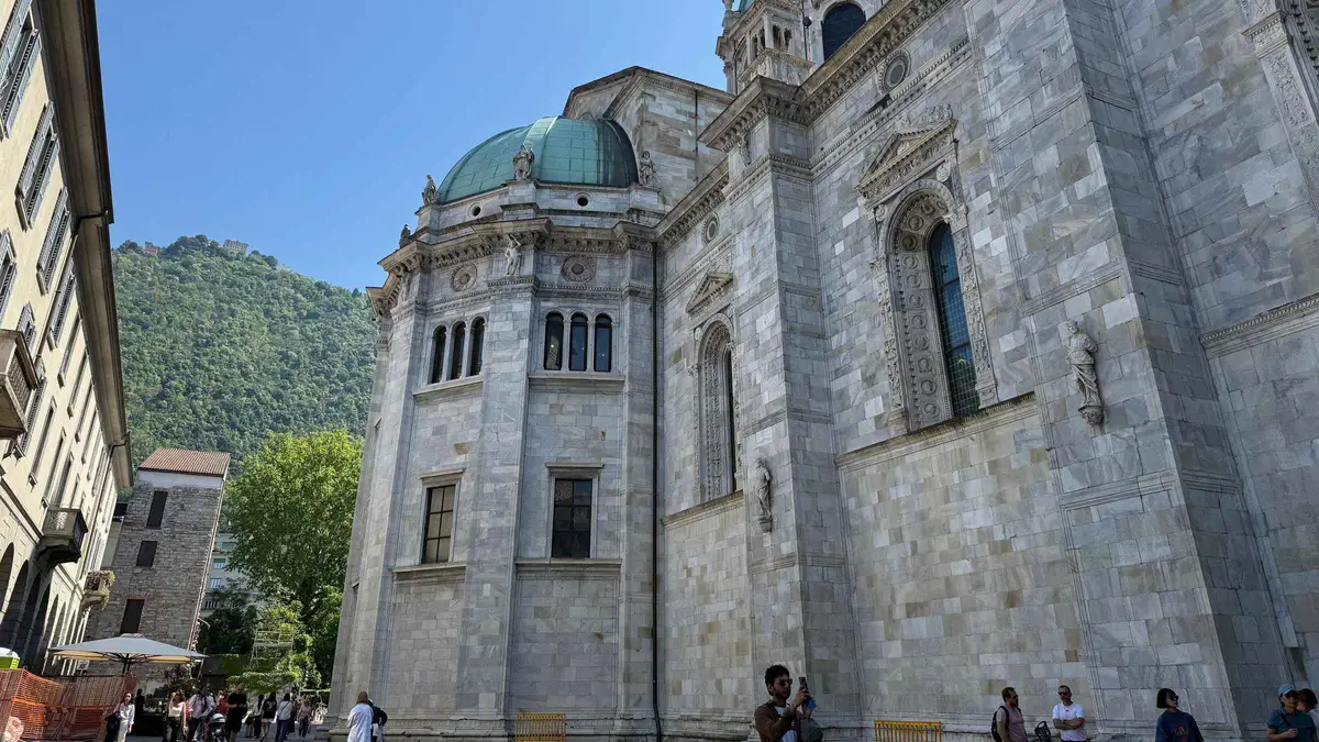
Como: Lake Como and Brunate Guided Walking Tour
Four hours on foot around Como with a guide, capped at five people, taking in the cathedral, the lakefront and the funicular ride up to Brunate and its lighthouse. The funicular ticket is included; lunch and the lighthouse minibus are not.
Check Availability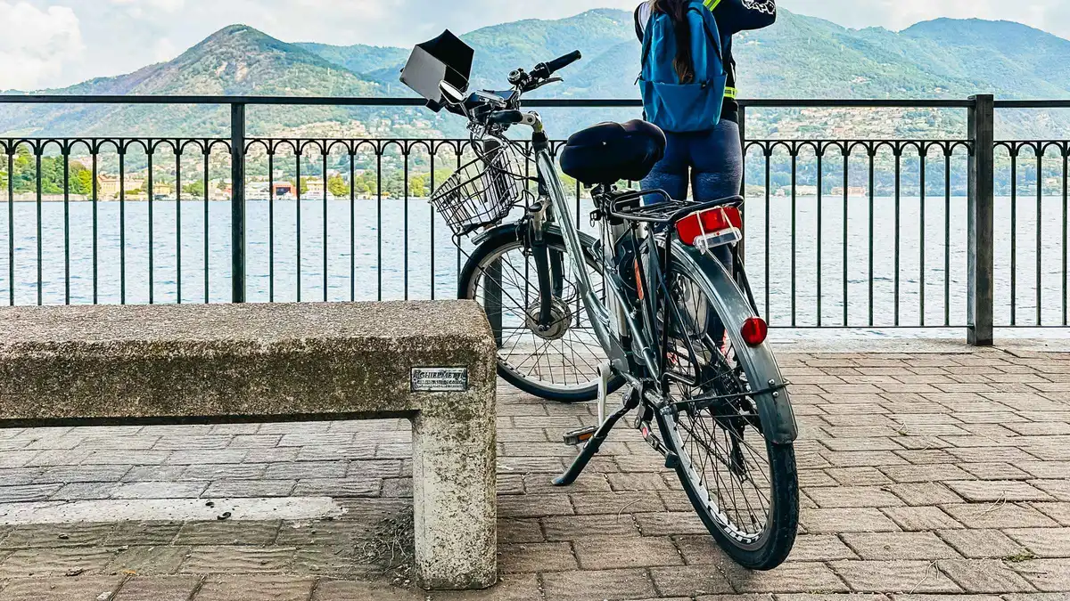 from $104.70
Top rated
from $104.70
Top rated Lake Como: eBike Tour with Live Guide, eHelmet, and iPad
Three hours on an electric bike around Como with a live guide, an audio helmet and an iPad on the handlebars. The exclusion list is the longest of any listing here: a 160 cm minimum height, a 130 kg limit, and you cannot take the bikes out unguided.
Check Availability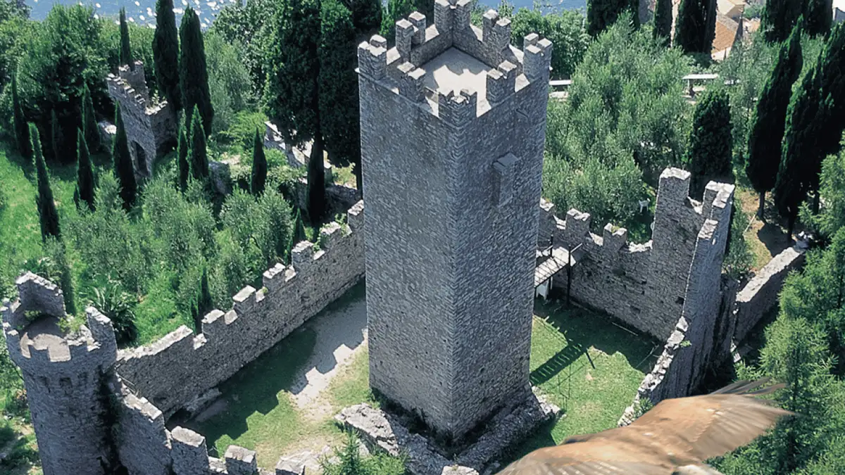 from $8.14
Varenna: Castello di Vezio Entry Ticket
The castle's own entry ticket for the tower, garden and dungeons on the ridge above Varenna, bought ahead. Nothing else is included — no guide, no transport, and the falconry the castle was known for has been permanently suspended since the 2022 vandalism.
Check Availability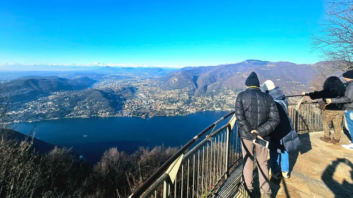 from $73.29
Lake Como Boat Tour with Brunate Funicular and Scenic Views
A one-hour shared boat tour out of Como with a Prosecco, bundled with a priority-access Brunate funicular ticket and free time to ride up and wander the old town. There is no guide in Brunate and no hotel pickup.
Check AvailabilityPrices, ratings and details are the platform's own, checked in Q3 2026; dollar figures are the listed prices — the platform bills in your account's currency.
Where a Walking Day Goes Next
Four pages that a Lake Como walk runs straight into.
The 11.2-kilometre lakeside route
Seven villages between Colonno and Griante, the stage detail, the trailhead and the live works page to check first.
The only walk here with a full technical boxCastello di Vezio
The gate at the top of the short loop, with its month-by-month hours and the summer evening openings to 22:30.
About 30 minutes above VarennaGetting around
Boats, buses and trains, including where the lakeside bus stops and why there is none to Varenna.
The bus lines are C110 and C130Best time to visit
Thirty years of rainfall and temperature by month, and the villa and boat calendars that move with them.
The wet season is the warm seasonLake Como Hiking: Questions
Can you go hiking around Lake Como?
Yes, and the terrain is genuinely mountainous: Tremezzina's comune territory runs from 198 to 1,689 metres and Lecco's to 1,849. What is missing is documentation. Only the Colonno to Griante lakeside route publishes a full technical description, at 11.2 kilometres with 221 metres of ascent and three and a half hours. The walks table sets out what every other named route does and does not publish.
What are the best hikes at Lake Como?
On the published evidence rather than on opinion: the lakeside route through the seven villages for a full day with real numbers, the Anello del Castello di Vezio from Varenna for a short one at about 30 minutes and 160 metres of climbing, and the climb through the fourteen chapels of the Sacro Monte di Ossuccio for the walk with the most to look at. The Sentiero del Viandante is the famous one and no authority publishes a stage list for it.
How long is the Sentiero del Viandante?
Not stated by any official source we could reach. Varenna's own tourism portal, published by the comune's tourism department, calls it an itinerary dating back to the Roman period that skirts the eastern branch of the lake and prints no length, ascent or walking time. The domain that appears to be the route's own site fails its certificate check. The one concrete thing on the record is that Villa Monastero halves its entry price for holders of a Viandante via Lago ticket, which tells you it is walked as a rail-and-trail combination.
Do I need a car for walking at Lake Como?
No, and a car is often the worse tool because the trailheads are villages with no visitor parking tariff published in Bellagio, Varenna, Menaggio or Tremezzina. The catch is that boat-reached trailheads run on a timetable that changes four times a year and some landing stages get two calls a day; the timetable table shows which. On the eastern shore the train is the better answer, because Trenord runs roughly hourly to Varenna and carries bicycles free within Lombardy.
Is there hiking near Brunate?
Yes, and the funicular is the reason to start there rather than anywhere else: seven minutes and $8.62 (€7.40) return buys you about 475 metres of ascent, it runs every day 06:00 to midnight, and tickets are not timed. ASF also runs a bus link from Brunate to the Rifugio CAO further along the ridge. No official source publishes a distance or a time for the ridge paths themselves, and Brunate, whose built-up centre ISTAT puts at 689 metres, is several degrees colder than the lakefront. Details on the funicular page.
What should I know before walking in the Grigne?
That the regional park publishes remarkably little. The Parco Regionale della Grigna Settentrionale's own routes section turns out to be five interpretive panels for a single Moncodeno itinerary, issued as PDFs, with no distance, ascent, time or difficulty grade. Lecco is the town to base in and to ask in, at the Infopoint in the Palazzo delle Paure, Piazza XX Settembre 23. Nothing on this page is a substitute for a proper map on that ground.
Walking Above Lake Como, on Film
Three films that show the terrain the missing route data is describing, including one walk of the Viandante section everyone asks about.
Hiking Lake Como's Famous Sentiero del Viandante | Bellano to Varenna
The eastern-shore section walked end to end, which is as close to a stage description as this route has.
Video: At Home on Lake ComoThe Most Beautiful Hikes in Lake Como, north Italy
A survey of the ridge walking above the water, useful for judging how steep the ground really is.
Video: Yi LiviaThe BEST Hike near Lake Como! (Monte San Primo)
The high ground behind Bellagio, filmed on a clear day, showing what the altitude table means in practice.
Video: Elsbeth WeeksVideos load from YouTube only when you press play.
Reviewed Q3 2026 (July–September 2026); next review Q4 2026. Prices, hours and terms are set by the venue or operator and confirmed at checkout.
We may earn a commission if you book through one of our links, at no extra cost to you. Full affiliate disclosure